Short surface opportunities
Midges and occasional small mayflies may still bring fish up in mild weather. Look for actual rises before committing to the surface.

Montana · Holter Dam to Craig
Plan your visit · Conditions and resources
Broad runs, grassy banks and rising trout give this tailwater its character. Explore the Missouri below Holter Dam, through Wolf Creek to Craig, using public access sites for a bank outing or a planned float.
Loading source readings…
Review the gauge trend and official notices before choosing a launch, takeout or bank access point.
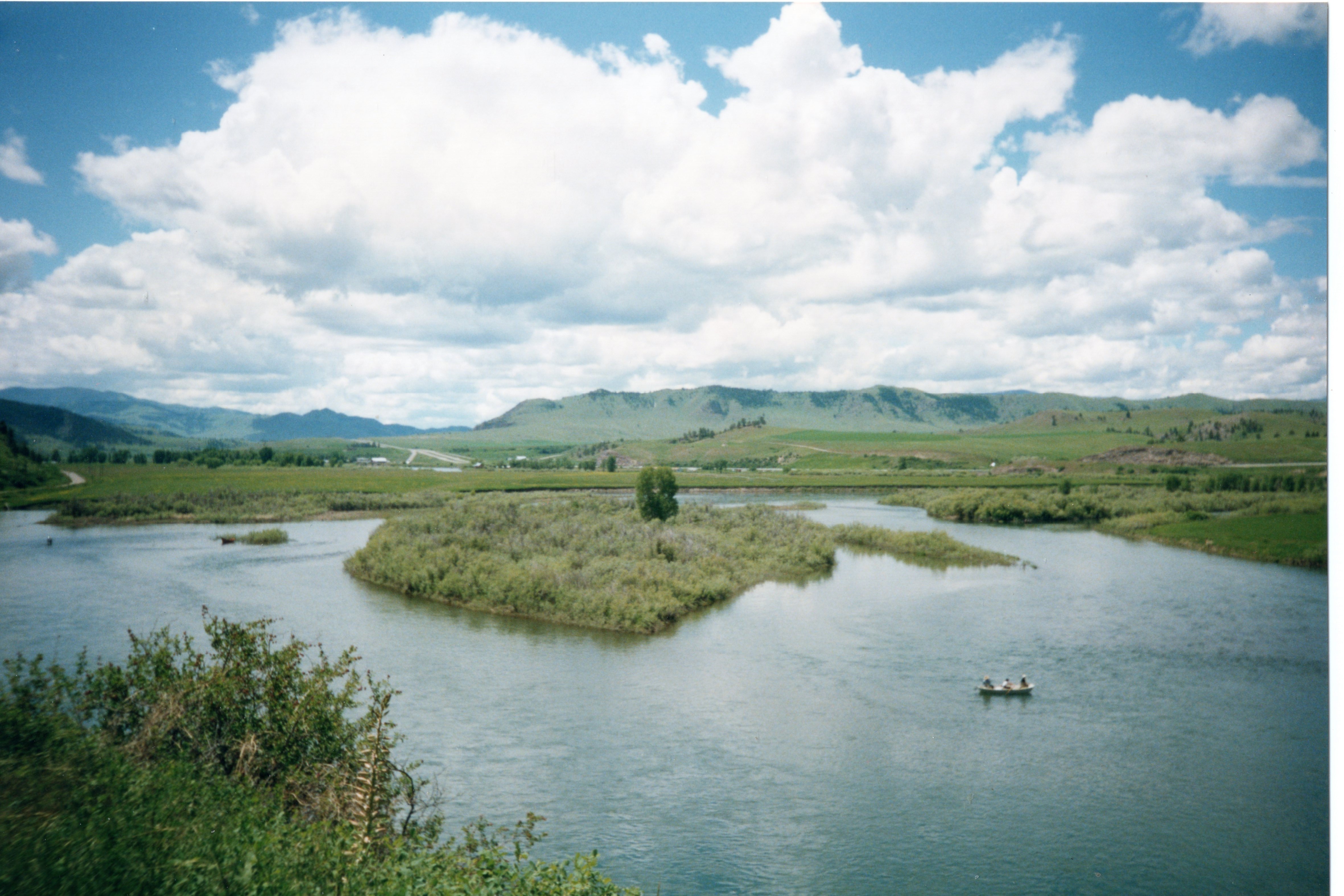 View full photo ↗
This month below Holter Dam
Seasonal guidance, not a current hatch report.
November
Midges and occasional small mayflies may still bring fish up in mild weather. Look for actual rises before committing to the surface.
Sowbugs, scuds and midge imitations offer options between hatches. Let the water and feeding activity determine your starting approach.
Holter Dam through Wolf Creek to Craig
Begin with established public access sites such as Holter Dam or Craig. Check the site map and posted boundaries; an access point does not make every bank public or every stretch suitable for wading.

Choose a launch and takeout from the official access map, then arrange a shuttle. Check ramp information and river conditions before committing to a float.
Notices are not automatically checked here.
Fishing regulations
Review Montana’s current fishing regulations and restrictions for the Missouri River below Holter Dam.
Getting to the water
Review official restrictions and access information before heading to your launch, takeout or bank access point.
From the river
Share a recent observation or help us correct this page. General locations are enough.
Help shape the next atlas
Would you use a hyperlocal illustrated atlas for the Missouri River? Let us know to help shape what we publish next.
Stay connected
New river resources, Journal stories and updates on our books and field cards.
After signing up, check your inbox for a confirmation link or welcome email.
Right-click the button in the email, copy its link and paste it into your browser. On a phone, touch and hold the button to copy the link.
Official USGS gauge ↗ · Official NWS forecast ↗
USGS station 06066500 · Missouri below Holter Dam near Wolf Creek. Forecast: National Weather Service · Craig area. Sources are normally requested hourly by WordPress; low traffic can delay scheduled work. Source observation times are shown with readings. Delayed readings are labeled and expired readings are hidden.
One gauge and forecast point do not describe the entire reach. USGS readings may be provisional and revised. Rules and access links are not automatically checked. Seasonal clues are editorial guidance, not a current hatch report.
Observations and atlas requests are stored privately for review. Newsletter signup is separate and requires confirmation through WordPress.com. Privacy policy.