Below Grey Reef Dam, the North Platte offers a focused Wyoming tailwater trip toward Government Bridge. This page covers Grey Reef rather than the separate Miracle Mile reach.
Reach focus
Grey Reef Dam to Government Bridge
Forecast area
Alcova, WY
Conditions at a glance
Mountain time
Loading source readings…
Check the river before setting out.
Releases and wind shape a day here. Check current rules, including gear and closure details, before leaving for the river.
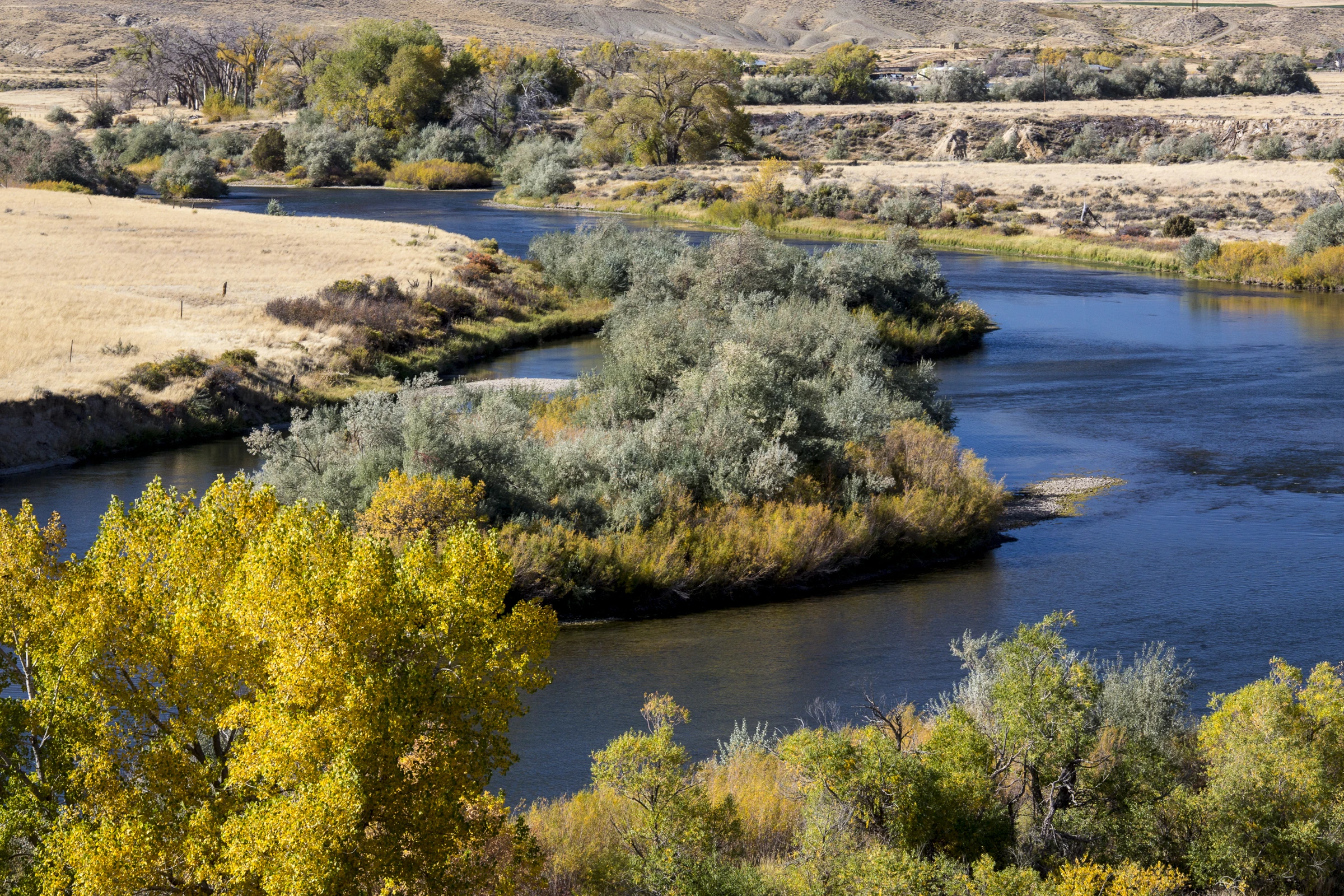
View full photo ↗An autumn bend on the North Platte in the Trappers Route corridor, Wyoming; position relative to Grey Reef and Government Bridge is unverified. · Bob Wick / Bureau of Land Management · CC BY 2.0. Resized; display crop. Not current conditions.
Look closer on this river
Seasonal clues
Seasonal guidance, not a current hatch report.
November
Read the season.
Shorter days and changing weather can shift feeding windows. Avoid spawning beds and match the legal season to the exact river section. Releases and wind shape a day here. Check current rules, including gear and closure details, before leaving for the river.
Match what you observe.
Midges, mayflies and drifting subsurface food are useful seasonal clues. Work on depth and drift before assuming a new fly is the answer.
Plan your visit
Alcova, WY
Grey Reef Dam to Government Bridge
On foot
Use designated public fishing access and respect private banks between sites. Check exact reach rules and seasonal spawning-area closures before fishing.
By boat
Plan an official launch-to-takeout route, arrange the shuttle and review releases. Open banks do not imply permission to stop on private property.
North Platte River below Gray Reef Reservoir near Alcova · GGWY. The official USBR HydroMet flow source is linked directly; a verified automated feed has not been connected on this page. Do not substitute air temperature. Only publish fresh measured water temperature at matching reach.
NWS forecast point: Alcova, WY (42.563,-106.684). Source jobs are staggered hourly; low traffic can delay WordPress scheduling. Observation times are shown. Old readings are labeled or hidden by age. Air temperature is never substituted for water temperature.
Seasonal text is editorial guidance. It is not an automated live hatch report. Rules and access notices are not automatically checked. One gauge cannot describe every place on the river.
Submissions stay private for review. An optional atlas-request email is for that river’s announcement only. Newsletter signup is separate. Privacy policy.